Our Services
Solutions That Cater to All
You can count on our team to deliver complete and outstanding results no matter the project or scope.
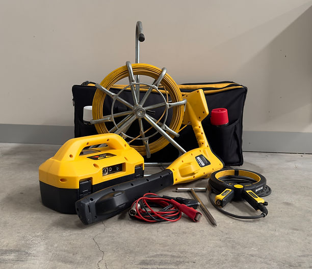
RADIO DETECTION
Radio detection equipment is U.S.D.'s main utility locating tool. Our 'CertLoc Certified' field professionals are equipped with 'R.D.' service locators, including the latest 'R.D. 8000' and 'ViVax vLoc3-Pro' models.
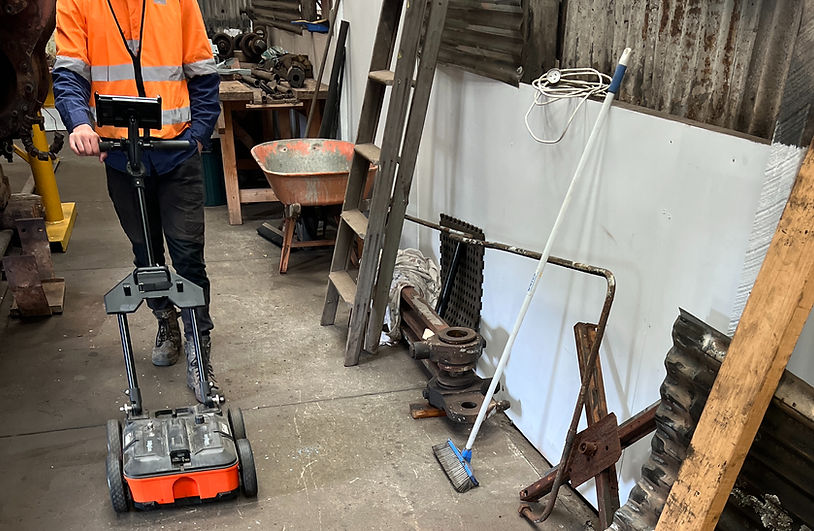
GPR
Our Ground Penetrating Radar (or 'GPR') uses electromagnetic radiation in the microwave frequency range to survey and identify underground features such as (but not limited to) concrete, asphalt, metal structures, pipes, and cables.
GPR is most commonly used to reveal hidden objects and services that are unable to be identified by conventional service locating equipment.

NDD
Our second most popular utility-based solution is Non-Destructive Digging ('NDD'). We utilise a high-pressure lance paired with a vacuum handled tube to safely expose and identify buried utilities and/or assets, and supply two units:
#1: SMALL UNIT (TRAILOR-MOUNTED)
Debris Tank Capacity: 800 Liters
Process Water Tank Capacity: 300 Liters
Water Pressure: 1,000 to 4,000 PSI
Vacuum Hose Diameter: 90 Millimeters
#2: LARGE UNIT (4X4 EPA TRANSPORT LICENCE)
Debris Tank Capacity: 3,000 Liters
Process Water Tank Capacity: 1,500 Liters
Water Pressure: 2000 to 5000 PSI
Vacuum Hose Diameter: 90 Millimeters

CONCRETE CORING
To further complement our other Non-Destructive Digging services is our concrete corer. We provide coring barrels in the following sizes:
120mm
205mm
250mm
300mm

RECORDS, DRAFTING & SURVEYING
At the base level, our professionals will identify and accurately mark any underground utilities on the ground with spot marking paint, chalk, pegs, and/or flags to ensure they can be identified by others.
We will then implement our Non-Destructive Digging services and confirm service depths, types, and sizes (if necessary).
Finally, our team will then create a record of all results that are found via sourcing sketches, pictures, GPS system data, CAD drawings, and any other material to ensure the information is accurate and usable.

PROJECT MANAGEMENT
Subsurface Utility Engineering ('SUE')
The main driving factor of the SUE process is to integrate quantitative data with design to develop solutions that ensure the safety of buried utilities during excavation works.
U.S.D. actively predicts (and therefore prevents) issues that may arise in the future through our streamlined project management service.

AERIAL MAPPING
High-quality rendered aerial mapping is available to provide clients with an accurate 3D model of their worksite. Our 'DJI Phantom 4 Pro Plus' is piloted by our CASA certified pilot/operator, and all data is imported and rendered via the 'Pix4DMapper' proprietary software.

SPECIAL REQUESTS
Have any special requests? Underground Services Detection is open to any and all requests, even those outside of the conventional scope we typically provide.